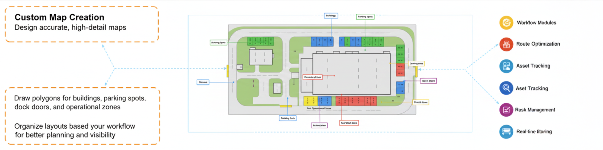
Menu

Virtual Yard Geofencing

Precision mapping and geofence creation powered by IndianRFID—designed for smarter, faster, and more accurate yard management.

IndianRFID’s Virtual Yard Geofencing transforms how businesses design, analyze, and manage operational spaces. Create geofences, draw boundaries, and export accurate coordinates — all without visiting the site. Powered by Google Maps and built for real‑world logistics, it brings speed, accuracy, and flexibility to yard, warehouse, and facility management.

Key Features
Custom Map Creation

Design accurate, high‑detail maps

Draw polygons for buildings, parking spots, gates, dock doors, and operational zones. Organize layouts based on your workflow for better planning and visibility.

Custom map creation
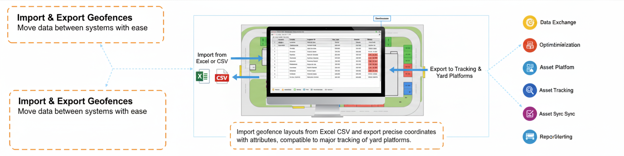
Import & Export Geofences

Move data between systems with ease

Import geofence layouts from Excel or CSV and export precise coordinates with attributes, compatible with major tracking and yard platforms.

Import export geofences
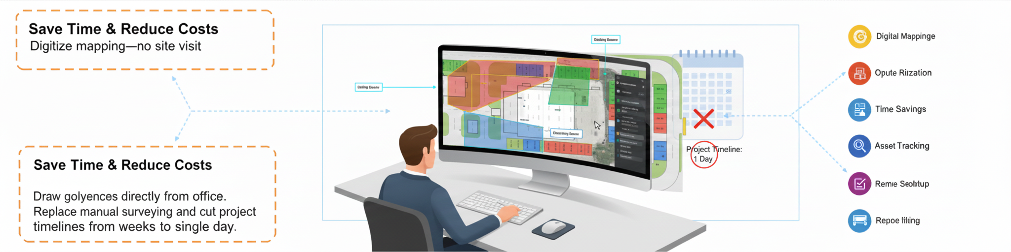
Save Time & Reduce Costs

Digitize mapping—no site visit

Draw geofences directly from the office. Replace manual surveying and cut project timelines from weeks to a single day.

Save time and costs
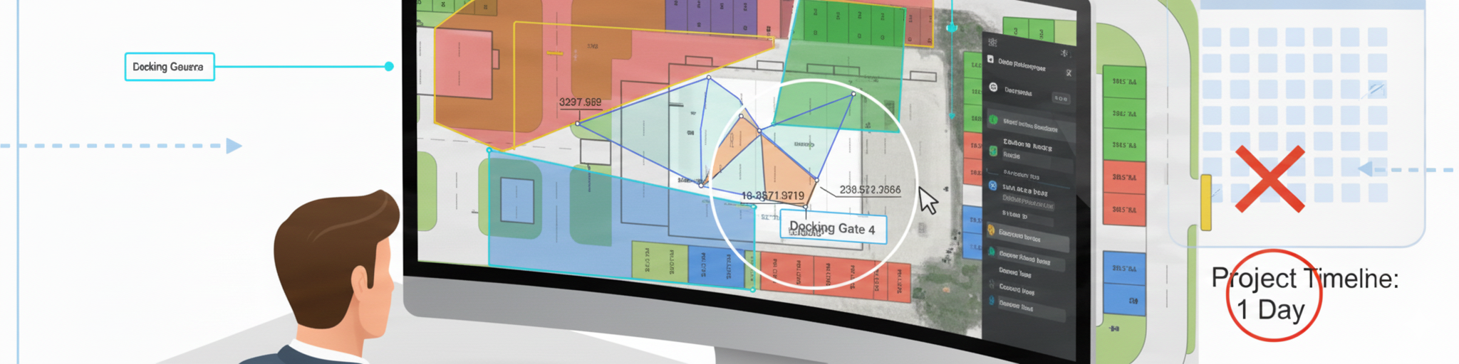
High‑Precision Mapping

Accuracy you can trust

Use highest zoom levels for exact plotting. Match or exceed manual measurement accuracy with stable, reliable coordinates.

High precision mapping
Simple to Use, Powerful Results

Built for beginners and experts

Intuitive interface with minimal learning curve. Export SQL‑ready data and integrate quickly with Spotlight DB, YMS, WMS, or any platform.

Powerful results
Key Benefits
Faster mapping workflows
Higher location accuracy
Real‑time operational visibility
Reduced manual work
Lower operational costs
Better productivity across teams
Seamless integration
Reliable tracking & automation
Customizable for every business
Who Can Use Virtual Yard Geofencing?
Warehouses & distribution centers
Logistics parks & transport yards
Manufacturing plants
Airports & aviation operations
Ports & container terminals
Theme parks & event venues
Security & monitoring campuses
Industrial complexes
Why Choose IndianRFID?

IndianRFID combines next‑generation mapping technology with real‑world industry experience. Virtual Yard Geofencing helps businesses digitize facility layouts, improve accuracy, enhance real‑time tracking, deploy geofences faster, and integrate smoothly with existing systems. From consultation to deployment, IndianRFID supports you end‑to‑end.

Start a Conversation

Hi! Click one of our solutions below to chat on Whatsapp

The team typically replies in a few minutes.